
The Penn State University data and research community has developed numerous applications, tools, and models that are accessible to the public. These Apps & Tools cover a wide range of themes and research interests and help to enhance teaching, outreach, and collaboration.
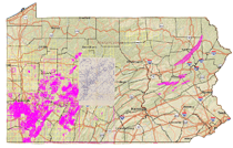 |
Mine Maps Atlas Coal mining has occurred in Pennsylvania for over a century. The maps to these coal mines are stored at various public and private locations (if they still exist at all) throughout the commonwealth. The Pennsylvania Department of Environmental Protection, Office of Active and Abandoned Mine Operations (DEP) is involved in many projects dealing with historic and active mine map restoration and digitization. The DEP has tried to preserve the historic information contained on these maps by scanning the maps into a digital image. |
 |
PennPilot Penn Pilot, was originally sponsored by the PA Department of Conservation and Natural Resources, Topographic and Geologic Survey. It is hosted by Pennsylvania Spatial Data Access (www.pasda.psu.edu) PennPilot, is an online library of digital historical aerial photography for the Commonwealth of Pennsylvania. Using the interactive map provided on this website, you can browse, view, and download thousands of photos covering the Commonwealth from 1937 to 1942 and 1967 to 1972. Images from the 1980s are now also available. |
 |
Cuticle Database The Cuticle Database Project, hosted by the PSU Earth and Environmental Sciences Institute, aims to promote the understanding and identification of living and fossil plants using the first large, unrestricted visual library of leaf cuticle available on the Internet. Most specimens so far deposited are illustrated with two images, showing the upper (left) and lower (right) cuticle surfaces. The images are accompanied by metadata, including herbarium voucher data that can be queried through either the simple or advanced search options. |
 |
FORAGES Forages are environmentally friendly in that they can reduce soil erosion, pesticide usage, and fertilizer application. In addition, forages can increase soil structure and organic matter and enhance agricultural profitability. In conclusion, Pennsylvania agriculture is synonymous with forages and their production and use. |
 |
Pennsylvania Imagery Navigator This interactive application serves as the One Stop Portal to all imagery and raster data by, for, or about Pennsylvania. Capabilities of the Navigator include viewing data, search and retrieval of data, and creating a list of imagery or raster data to download. Functionality includes navigating the map, zooming automatically to a street address, and downloading the available images in MrSID, JPEG 2000, or TIFF formats. Dynamic links are included for images that are available from multiple time periods, data providers, and formats. |
 |
Pennsylvania Integrated Hydrologic Modeling System (PIHM) PIHM is a multiprocess, multi-scale hydrologic model where the major hydrological processes are fully coupled using the semi-discrete finite volume method. The model itself is "tightly-coupled" with PIHMgis, an open-source Geographical Information System designed for PIHM. |
 |
Farm Energy Analysis Tool (FEAT) The Farm Energy Analysis Tool (FEAT) is a static, deterministic, database model, that was created to use a whole-farm approach to evaluate energy and greenhouse gas (GHG) emissions for different agricultural systems. This simple, yet effective, computer modeling approach allows for a rapid evaluation which provided useful estimates needed for agricultural researchers. |
 |
Pennsylvania Atlas The Pennsylvania Atlas was designed to provide enhanced visualization and data download capabilities through an online mapping interface. With the PA Atlas you will be able to view, download, and create your own maps using data available through PASDA. The data in the PA Atlas includes statewide boundary files, transportation, wildlife, conservation, recreation, and health data layers to name a few. Users can search for data by county or address or simply zoom in to their area of interest. By using our identify function, users can see data attributes such as road names, traffic counts, state park names and link directly to websites related to data for more information. If you would like to create your own map, simply select your data layers and use our map making function to create a PDF, JPG or PNG file to download. |